
Our product · Civic tech

RoadWiz242, a pothole map run by the community.

A free tool for reporting potholes in Nassau and across The Bahamas. Anyone can pin a pothole, add a photo and send it to the Ministry of Works in one tap, with no sign-up and no app to download.

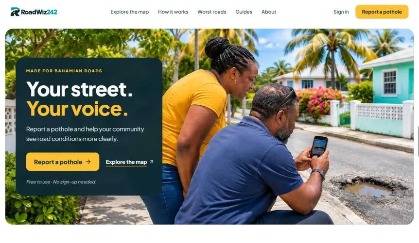
Homepage of RoadWiz242, the community pothole map built by First Glance Bahamas
RoadWiz242 logoLive productNew Providence & Paradise Island
Type
Our own product
Status
Live and free to use
Coverage
New Providence & Paradise Island, Family Islands next

Why we built it

Every driver knows where the potholes are.

Potholes are part of the daily drive, but reports get lost in comments and group chats. We built RoadWiz242 so neighbours can put them on one shared map, and so the Ministry of Works gets the exact locations it needs to act.

What it needed to do

  • Let anyone report in seconds, with no account
  • Pin the exact location, with a photo
  • Get reports to the Ministry of Works in one tap
  • Show every report on a live, public map
  • Let neighbours confirm a pothole or mark it fixed
  • Work on any phone, with no app to download

Free to use, always.

How it works

Report in seconds. No account needed.

No sign-up and no app download. Reporting a pothole takes four simple steps, and every report helps build the community picture.

  1. 01

    Pin the location

    Drop a pin exactly where the pothole is, on any phone.

  2. 02

    Add a photo

    A quick photo helps neighbours and road crews see the problem.

  3. 03

    Send it to the Ministry

    One tap shares the pin, street and photo with the Ministry of Works WhatsApp hotline.

  4. 04

    Follow updates

    Neighbours confirm it’s still there, or mark it fixed, so the map stays accurate.

Inside the product

A clearer picture of our roads.

Live community map

Every report, on one live map.

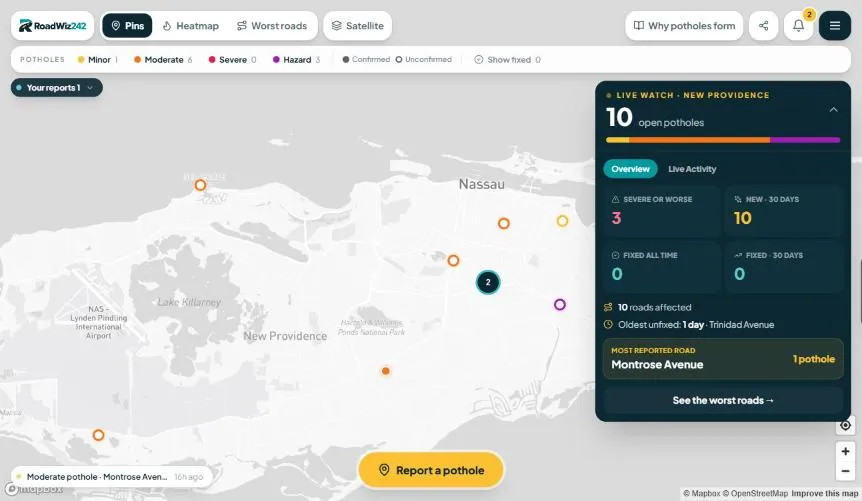
Pins, a heatmap and a satellite view show where the potholes are. Reports are graded from minor to hazard, and a live panel tracks open, severe and fixed potholes across New Providence.

  • Pins and heatmap
  • Severity levels
  • Satellite view
  • Live stats
RoadWiz242 live pothole map of New Providence with severity levels and live stats
The RoadWiz242 live map

Weekly Worst Roads

The worst streets, ranked every week.

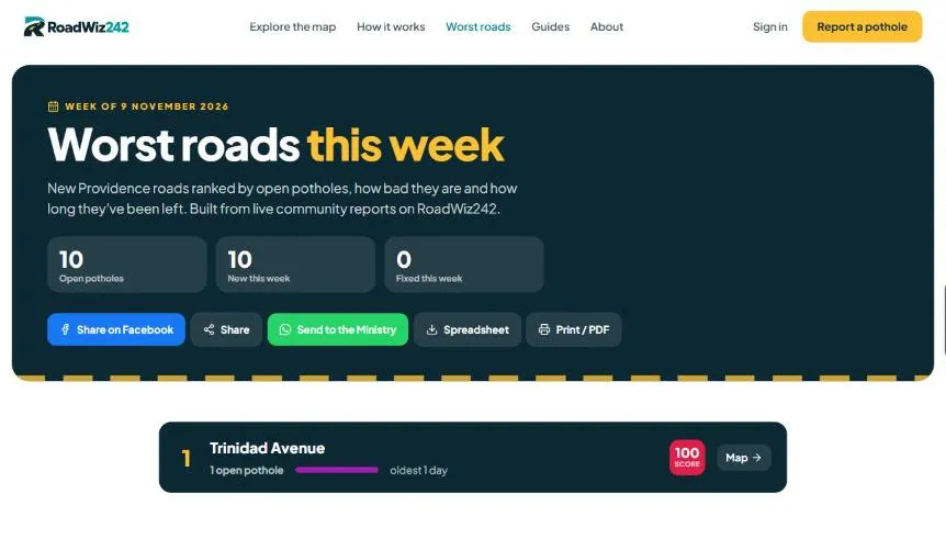
Roads are ranked by open potholes, how bad they are and how long they’ve been left. Each week’s list can be shared to Facebook, sent to the Ministry, or downloaded as a spreadsheet or PDF.

  • Weekly ranking
  • Share to Facebook
  • Send to the Ministry
  • Spreadsheet and PDF
RoadWiz242 weekly Worst Roads ranking for New Providence
Worst roads this week

Built for the community

People-powered, by design.

  • Open to everyone

    Every report is public, so everyone sees the same picture.

  • Neighbours confirm it

    Votes show what’s still there and what’s been fixed.

  • Straight to the Ministry

    Reports reach the people who fix the roads, with the exact pin and photo.

  • Free, always

    No sign-up, no app download and no cost to report.

What we built

Designed, built and run by First Glance.

Concept, design, build and day-to-day running, by the same team that builds for our clients.

  • Product concept and design
  • Mobile-first web app
  • Live map with pins and heatmap
  • Photo reports
  • One-tap WhatsApp to the Ministry
  • Severity grading
  • Neighbour confirmations
  • Weekly Worst Roads ranking
  • Facebook sharing
  • Spreadsheet and PDF export
  • Pothole explainer guides
  • SEO
  • Hosting and day-to-day running

Start a project

Tell us what you want your business to do better.

A sharper website, an app your customers use, a system that gives your team hours back. Tell us the goal and we’ll tell you plainly whether we can help, and what it would take.

Prefer to reach out directly?

Based in Nassau, The Bahamas. Working with clients across the Caribbean, North America and beyond.